Central America Topo Maps 7.2.2
Free Version
Publisher Description
Central America Topo Maps - Central America Topo Maps 1:50.000
Easy to use outdoor and navigation app with 1:50.000 topographic maps of Guatemala, Honduras, El Salvador and Nicaragua.
This app gives you similar mapping options as you might know from Garmin or Magellan GPS handhelds.
Main features for outdoor-navigation:
• Create and edit Waypoints
• GoTo-Waypoint-Navigation
• Create and edit Routes
• Route-Navigation (Point-to-Point Navigation) (NOT in this free version !)
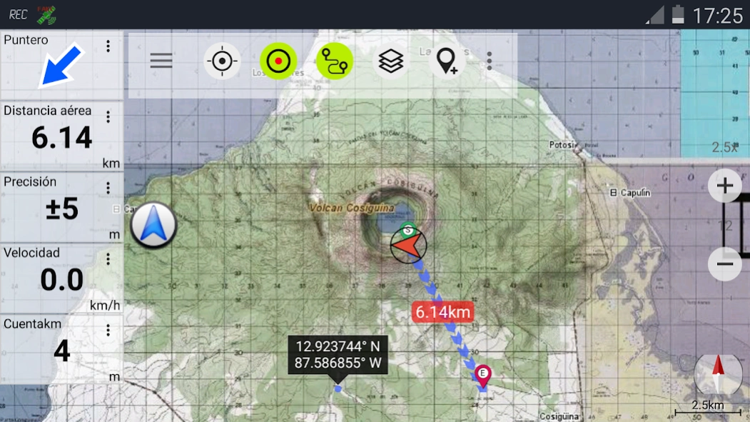
• Track Recording (with speed, elevation and accuracy profile)
• Tripmaster with fields for odometer, average speed, bearing, elevation, etc.
• GPX-Import / Export, KML-Export (NOT in this free version !)
• Search (placenames, POIs, streets)
• Customizable datafields in Map View and Tripmaster (e.g. Speed, Distance, Compass, ...)
• Share Waypoints, Tracks or Routes (via eMail, Facebook, ..)
• and many more ...
Available map layers:
• Topo maps 1:50.000 and 1:250.000 with seamless coverage for Guatemala, Honduras, El Salvador and Nicaragua. Belize, Costa Rica and Panama are covered with 1:250.000 topo maps.
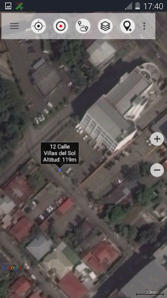
• Google Maps (Satellite images, Road- and Terrain-Map)
• Bing Maps (Satellite images, Road-Map)
• Open Street Maps (OSM Mapnik and Cloudemade Cyclemap)
• Hillshading overlay layer for OSM, Google or Bing maps
LIMITATIONS OF THIS FREE VERSION:
• Ads
• No Bulkdownload of maps for offline usage
• No Hillshading overlay
• Max. 3 Waypoints
• Max. 3 Tracks
• No Routes
• No import of waypoints and tracks
• No Bulkdownload
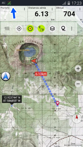
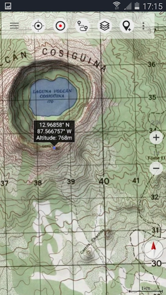
On the 1:50.000 maps you'll find many small roads, pathes and 4WD tracks that are not included in Google, Bing or OpenStreetMaps. The topo maps have a very detailed topography with contour lines. There is no other online mapping service/app available that gives you more detailed geographic features like rivers, lakes, hills, vegetation, villages, etc. for this region.
The topo maps layer is a seamless mosaic of more than 1000 georeferenced maps. Although some of the maps are quite old (production range of the maps is 1955 - 2006) they are still very good for outdoor trips, especially if you are looking adventurous routes or abandoned places. Most maps of Guatemala are quite up to date (mostly created in the 90ies) while maps of eastern Nicaragua were created in the 60ies/79ies. Within the app you can open an overview map with the publishing dates of the maps.
In larger cities you'll find it more usefull to switch to Google or OSM maps but in the backcountry you will recognize the relevance of large scale topographic maps.
The 1:250.000 maps are JOGs (Joint Operations Graphic) which represent a medium scale map intended as both a topographic and an aeronautical chart.
Use this navigation app for outdoor activities like hiking, biking, camping, climbing, riding, canoeing or offroad 4WD tours.
Preload FREE map data for areas without cell service.
The topographic maps are enhanced with Atlogis® hillshading and placenames.
Original publisher of the 1:50.000 topo maps : United States NGA (National Geospatial-Intelligence), NIMA (National Imagery and Mapping Agency), DMA (Defense Mapping Agency)
Original publisher of the 1:250.000 topo maps: US NGA/NIMA JOG (Joint Operations Graphics)
Please send comments and feature requests to camaps@atlogis.com
About Central America Topo Maps
Central America Topo Maps is a free app for Android published in the Geography list of apps, part of Education.
The company that develops Central America Topo Maps is ATLOGIS Geoinformatics GmbH & Co. KG. The latest version released by its developer is 7.2.2. This app was rated by 1 users of our site and has an average rating of 4.0.
To install Central America Topo Maps on your Android device, just click the green Continue To App button above to start the installation process. The app is listed on our website since 2024-03-10 and was downloaded 23 times. We have already checked if the download link is safe, however for your own protection we recommend that you scan the downloaded app with your antivirus. Your antivirus may detect the Central America Topo Maps as malware as malware if the download link to com.atlogis.centralamerica.free is broken.
How to install Central America Topo Maps on your Android device:
- Click on the Continue To App button on our website. This will redirect you to Google Play.
- Once the Central America Topo Maps is shown in the Google Play listing of your Android device, you can start its download and installation. Tap on the Install button located below the search bar and to the right of the app icon.
- A pop-up window with the permissions required by Central America Topo Maps will be shown. Click on Accept to continue the process.
- Central America Topo Maps will be downloaded onto your device, displaying a progress. Once the download completes, the installation will start and you'll get a notification after the installation is finished.
